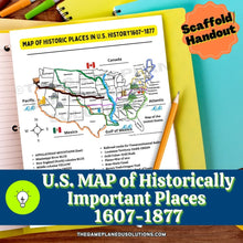
Need to help your learners remember the geographic location of historically important locations?
Forget pointless copy-and-color activities for reviewing geography! Make your lesson intentional as you pre-teach places of historical importance in U.S. History from 1607 to 1877!
These U.S. maps are great for:
- Direct instruction
- Geography assessments to check student background knowledge or understanding
- Review games
- Reference material for interactive notebooks
- Includes locations such as the Oregon Trail, Jamestown, Trail of Tears, Missouri Compromise line, and MORE!
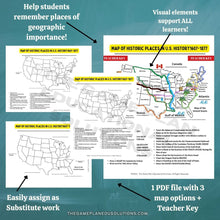
Visual icons make this map adapted for all learners!
What you get:
✅ 4-page PDF document (1 landscape version, 1 portrait version, 1 blank map, and the Teacher Key). Non-Modifiable.
✅ Quick to download and print; or assign for online completion via Kami.
✅ Easy assignment for substitutes to complete with your class.
✅ Great as a student scaffold to refer back to throughout the school year!
👉Ideal for Middle School and Up+
📝TERMS OF USE:
This Handout is designed for individual classroom teachers for instructional purposes only and may NOT be used/mass-produced/shared /re-created/etc. free or paid, to others who are not the students of record learning from the teacher that purchased the license. For additional licenses, a separate purchase can be made.
This handout is not designed to be used by any Consultants/Trainers/Programs/University Campuses etc. as a training tool/sample for their students on educational practices/pedagogy/methodology etc.
All Rights Reserved.


